
The Subway Bottom-Up

Difficulty: Strenuous, wet hike, but worth it!
Elevation Gain/Loss: 1000 feet / 300 meters gain
Average Hiking Time: 5 - 9 hours round trip
Distance: 7 rugged miles / 11.2 km round trip
Trailhead Location: Left Fork Trailhead off of Kolob Terrace Rd
Optimal Time to Hike: Year round; get an early start in summer - its very hot; drypants often needed in spring/winter.
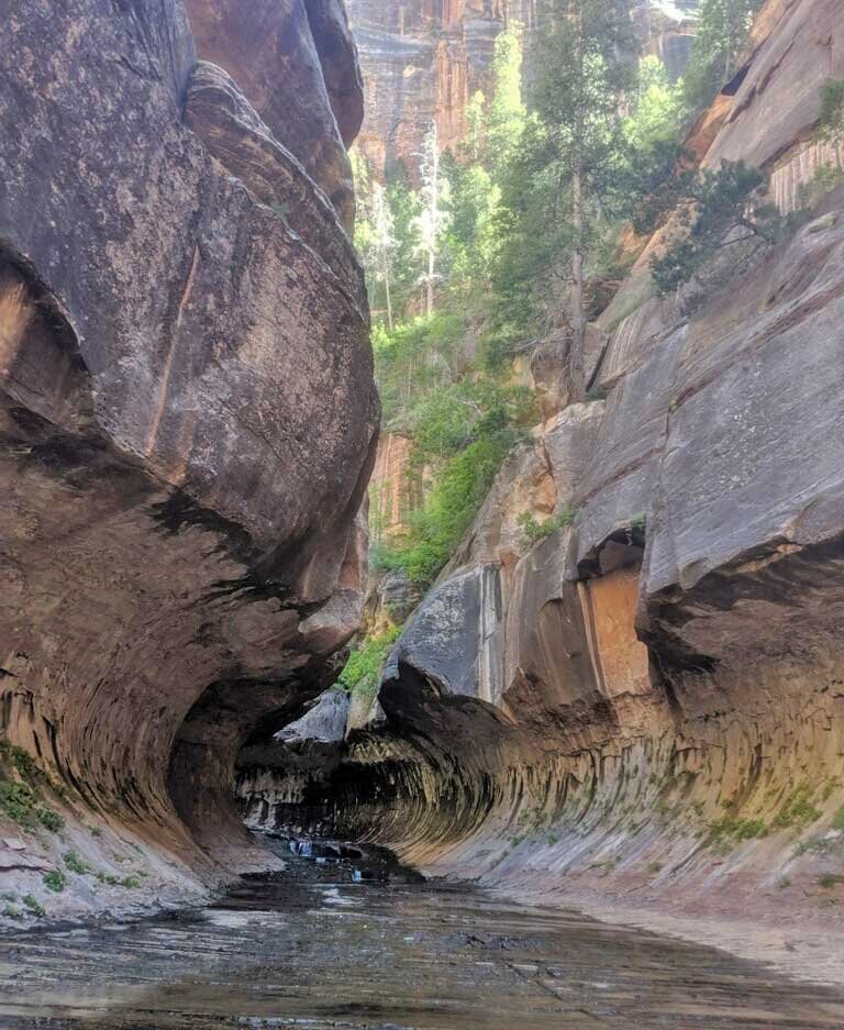
Experience: For good reason Zion’s most popular off-trail route. This description does not provide sufficient information without the required wilderness permit and detailed maps and route information. This out-and-back hike descends steeply into the Left Fork drainage, continuing up-river along a generally knee-deep creek, past amazing red waterfall staircases, until reaching surreal emerald green water holes, incredibly aesthetic canyon walls, and the ribbon waterfalls which define the Subway. About halfway into the hike, grey rock slabs host dinosaur tracks on river left (looking up-canyon). Please do not touch or harm the dino tracks! Missing the exit is common, so make note of the geographic features at the junction on your way in. Save time and effort by hiking in the creek when expedient; trying to stay dry is inefficient (and less fun). In order to truly experience the Subway, you need to hike all 3.5 miles / 5.6 km. Even 1/4 mile / 0.4 km shy, you will miss the best views! In the summer be sure to get soaking wet before the steep exit. Shoe and gear rentals available for the Subway at Zion Guru.